Route Planning - Italian TET Options
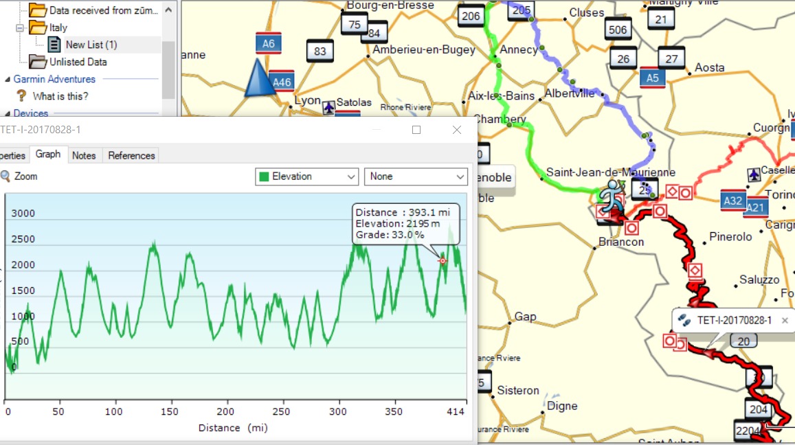
I've been discussing the routes with Jason, the first option (shown above) is to head south from Geneva and meet the TET in the Alps. From there continue heading south all the way to Monaco over the Alps. This section is the highest part of the Tet in Italy, it's a few hundred miles over the Cols and it looks mighty impressive. Green and blue are from Genava to the TET. Green is 117 miles and 3.30hr. Red is 'TET1' to Monaco. TET1 is 414 miles and snakes over the highest peaks. Look at the elevation graph! Some track and some mountain roads

Option two (above) is South from Geneva again to meet the Tet but this time head on 'TET 2,3,4' snaking east for approx 400 miles towards Slovenia through the Lowlands of Northern Italy. I say 'lowlands', but on the first section you're still 2000m up. This route gives more options to visit towns and multiple routes over the Alps back to Geneva (for BikeShuttle)
The image below gives a Birdseye view of the options.

I sent the options to Jason. I suspect he's going to prefer the east route over to Slovenia because the riding looks a little faster, meaning we will cover more ground and get to see more of Northern Italy as a result. Plus you can get tired of mountains. We both got mountain fatigue on the last trip, I dont know if that's a 'thing', but it's how I felt - i really was happy to be back in the rolling green lowlands and leave the cold misty hairpins of the Pyrenees behind.
Still, I'm finding it hard to choose: Cover ground and see northern Italy or over the top and end up on the Mediterranean Coast for a night. The thought of bikini clad french farmers daughters on the beech is hard to shake.... (Do they even exist?). Ahhh first world problems, tough life !
~2.jpg)

Comments
Post a Comment