Basecamp Mapping
Edit Jan 2023 - My biking travels have taken me further afield than i imagined when I initially wrote this page. Now updated for to reflect such travel and remove older websites.
Mapping; a dark art? Not to me, its something i enjoy and grants the opportunity to know the route before you ride it. My mind turned to mapping years ago on road bikes before GPS' could select 'curvy roads'. To this day, im normally the guide when i ride with friends. Now, years later, and after experiences, where the road maps are insufficient for off road sections i needed to update my skills.
Aside from the maps provided by the GPS manufacturer, which will cost money, you can use OSM. Open Street Map is a geographic database updated and maintained volunteers, its excellent and in some off-road cases is better than purchased maps. For road travelling, searching for fuel and hotels, the paid Garmin maps are often better imo.
Aside from the maps provided by the GPS manufacturer, which will cost money, you can use OSM. Open Street Map is a geographic database updated and maintained volunteers, its excellent and in some off-road cases is better than purchased maps. For road travelling, searching for fuel and hotels, the paid Garmin maps are often better imo.
For the best of both worlds use Zumo that has the full Garmin City Navigator EU / Africa road map too. I use the Garmin map for road riding quickly to towns for supplies and fuel stations. With two devices i keep one on an Openstreetmap and the other on the Garmin map.
1. openstreetmap wiki


2. opentopo
It contains pre-configured maps for Garmin devices, but they dont have maps for installation into Basecamp for all countries (EU and North America are fine, Africa just has files for the GPS device) All maps are downloadable by country from a list, so little configuration is required on the web site, just point, click, download. The data sizes are large, but the detail is good and they fit on the SD cards inside the devices.
1. openstreetmap wiki
wiki.openstreetmap.org
Open Street maps allows you to download maps to your computer for installing on a Garmin from any part of the world. The best part? They are all free!
Open Street maps allows you to download maps to your computer for installing on a Garmin from any part of the world. The best part? They are all free!
This site brings together map making resources from all over the web into one easy list. The maps differ in content, but the site given enough information for you to make an informed choice. Just read the notes (see 4, below)
Use the table to locate the are of the world you're interested in. Look for a regular updates (1), routable (2) and with a basecamp file (3) for your chose operating system (Apple or Windows)

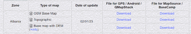
My personal favourite in 2023 is alternativaslibres, but your needs may differ.
alternativaslibres
The link above will take you directly to the download page. I like alternativaslibres as the file sizes are small for downloading on poor connections. The maps contain good off-road data and an installer file for basecamp, making the configuration onto the computer easy.
The road data allows route mapping and the TET looks fine on it. (ie.. all the routes appears on the map as roads or tracks)
I've upload this to both a Garmin Oregon and a Zumo.
I've upload this to both a Garmin Oregon and a Zumo.
Simply choose your Zone, the type of map (OSM Base is normally good) and download for basecamp.
Install with the default setting and restart basecamp.

Sample detail from Atar in Mauritania, the pink lines are my routes.

...and detail of the town

Garmin provide the topographical map style for their devices, so the maps from the following site will look more familiar.
It contains pre-configured maps for Garmin devices, but they dont have maps for installation into Basecamp for all countries (EU and North America are fine, Africa just has files for the GPS device) All maps are downloadable by country from a list, so little configuration is required on the web site, just point, click, download. The data sizes are large, but the detail is good and they fit on the SD cards inside the devices.
I note that many of the place names in appear misspelled on my device, thus all thing considered i currently favour alternativaslibres.

Garmin

Garmin
The final choice would be to download the maps from the Garmin site for a cost. Maps are £40 - £80 and some countries require multiple regions.
Software
I used to exclusively utilise Mapsource, but ive since swapped to Basecamp. It lends itself to 'Tracks' better than Mapsource and allows the 'tracks' to be converted to 'routes' easily.
A track; is a just a 'line' that you draw over the base map. It's free form and allows you to draw anywhere, unencumbered by the restrictions of road. Its your only option for off-road sections and does not show directions, ie, the GPS wont tell you to 'turn right in 200m', you just have to keep your vehicle on the line.

A route; is the standard method we all use in our car satnavs. You type in an address and the satnav tailors the best road route to suit your criteria and you get full turn by turn instruction. Using Basecamp and the route option you can actually draw a route over the roads, basecamp ensures the route complies with the laws of the road and prevents you going down one way streets. This enables you to select the roads you want to travel on. Car drivers want to get to a destination, bikers want to enjoy the journey, Basecamp enables the latter.
Basecamp allows you to convert tracks to routes, or vise versa. Remember, routes will always conform to a road, thus you need a 'routable' basemap. I find myself using both interchangeably depending on requirements, for example, it's not ideal to follow a track over a complex junction.

Conversely, a track displays elevation data, which is great on road or off road when planning your trips
Uploading either is the same process to the devices. Both the Oregon and the Zumo can use tracks or routes. The zumo has a lower limit on track 'points', but i've never reached it on the newer Zumo models.


Comments
Post a Comment